Information about the town of Svoge
Svoge Properties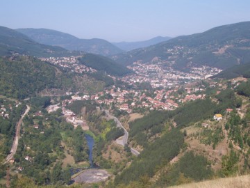 At the heart of the Iskar gorge in cool and cozy valley, hidden in the recesses of the mountain, is located a neat little town. Its name is Svoge. Cheerful and friendly, surrounded by beautiful nature, the town is a favorite place for recreation and tourism.
High above the city peak Grohoten (1045 m) welcomes lightning and thunder, and below in the valley river Iskretska quietly given its turbulent waters to Iskar river. Three mountains touch the ridges around Svoge (Mala planina mountain, Golema planina mountain and Ponor mountain) and their embrace defendsthe city from winds and storms. The place where is located our city as if blessed by God - even the name suggests this ofSvoge. According to some - it comes from the word "savodie" - the merging of the waters of the two rivers.
Svoge municipality covers an area of 866 square kilometers and is one of the largest territory in the Republic of Bulgaria. Located about 40 kilometers north of the capital, in the western part of Stara Planina Mountains. Svoge Municipality consists of one administrative center - the town of Svoge and 37 more settlements.
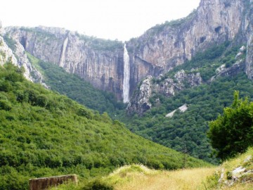
Svoge Municipality is the traditional territory of mass tourism. There are chalets and several marked tourist routes. In this number is also the named after the great Bulgarian author "Vazova eco trail”. Heavily forested mountainous terrain favors the development of hunting tourism. Main type of game that are hunted in the area is the wild boar, deer and European roe and predators. The area of the municipality is located Svoge protected area "Laktnishki Rocks" - a majestic cliff with sheer walls, part of the left slope of the Iskar gorge from the eastern spurs of the mountain Koznitsa in Western Stara Planina. Located opposite the railway station Lakatnik 20 km north of the city Municipality. It is constructed of Triassic red sand and thick limestone. 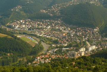 For millenniums, erosion has created a fantasy world of rock formations rising up to 250 meters. At the foot of the cliffs is the "Dark Hole" - the longest cave in the Stara Planina Mountains. There is a marvelous underworld of 20 lakes, underground streams, several waterfalls, galleries, and others. At the foot of the rocks gush spring Zhitolyub, near which there is a restaurant, a park and a lake. In the area of Lakatnishki rocks are recognized mountaineering and caving. They are recognized mountaineering object. Area creates conditions for development of extreme sports.
 For millenniums, erosion has created a fantasy world of rock formations rising up to 250 meters. At the foot of the cliffs is the "Dark Hole" - the longest cave in the Stara Planina Mountains. There is a marvelous underworld of 20 lakes, underground streams, several waterfalls, galleries, and others. At the foot of the rocks gush spring Zhitolyub, near which there is a restaurant, a park and a lake. In the area of Lakatnishki rocks are recognized mountaineering and caving. They are recognized mountaineering object. Area creates conditions for development of extreme sports.
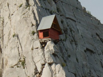
Lakatnishki rocks the cradle of Bulgarian alpinism. In 1931 there is use for the first time in our alpine rope. Small hut built by volunteers in 1938 climbers lures wildest lovers of heights. High rocks in a glorious stone monument built in memory of the rocks thrown in 1923 participants in the September uprising. The municipality boasts more than 80 cultural, historical and archaeological monuments, monasteries and other preserved Bulgarian spirit, culture and literature. The most visited is the famous monastery "Seven Thrones". It is located in one of the loveliest spots in the Valley Gabrovnica in the picturesque mountain peak under Izdremets. Visited in the past, mostly worshipers now is a wonderful tourist destination for summer and winter holidays. Svoge Municipality is a traditional area for recreation. On its territory there are over 17 000 private villas.
History
The first known inhabitants of the history of the region Svoge are Thracian tribe tribals. From this period date several forts, the most famous one in the village Zasele whose Thracian name is Meteriz. There are three cemeteries. Found were in Iskar Gorge coins IV - I century BC that show at that time the area was in trade relations with the Mediterranean world. In Roman times the gorge there was a settlement, which is to maintain existing Roman road running from Serdica for the northern provinces of the Empire. At the foot of Mount Grohoten were found coins from the late Roman and early Byzantine period IV - VI century. Found were also13 fortifications built or repaired during the same period, whose purpose was to stop the invasion of the barbarians.
 Since the end of the V century the Slavs came. One of the permanent ways of their settlement goes through the Iskar Gorge to Sofia field. These lands included within the boundaries of the First Bulgarian Empire in the early ninth century, when the troops of Khan Krum passed away, to seize an important strategic center Sredets. There are legends that say that the troops of Khan destroyed the troops of the Byzantine army of Emperor Nicephorus I Genikos near the village Gubislav, and where the village has its name from. Sufficient data on early medieval period goes back to two of the villages that exist today - the village Iskrets and the village Svidnya. From the time of the Second Bulgarian Country dated two churches in the municipality - in the village Druzhevo and in the village Mecha polyana /today Iskrets/.
After the fall of Bulgaria under Ottoman rule, the population in the area increases significantly. This is conditioned by the desire of the Bulgarians to move away from the Turkish administrative centers, seeking refuge in inaccessible mountain gorges and settled permanently over the years. In most of the villages at that time registered churches built were in the XV - XVI century. Defenders of the local population during this period were rebels, the most famous of which are father Martin and Valchan leader.
In 1871 here comes the hero of Freedom - Vasil Levski. He arrived here with the task of a revolutionary committee and visited the monastery church "St. Petka" in the Municipality. His intentions were frustrated for reasons unknown, but the memory of his visit is still alive today.
After the Liberation of Bulgaria Svoge area is comparatively backward economically. The main occupation of the population are primitive agriculture, farming and logging. At the end of the nineteenth century was drawn railway line Sofia - Roman.  Svoge station was developed and around it gradually formed the settlement. By 1900 the administrative center of the region is a village Iskrets but gradually this became Svoge due to its economic and strategic positions. After the passage of railroad life in Iskar Gorge gradually changed. Around the railway Station arise many villages in the coming entrepreneurs, artisans and administrative officials. Open to workshops, quarries, lime. Begin the digging of hard coal. In 1924 were founded by entrepreneur Velizar Peev, sugar factories and chocolate factory in Svoge, with 200 workers. Much of the population is making a living from the railways. The region had many schools and community centers. In natural administrative, economic and cultural center makes Svoge, a municipal center today.
 Svoge station was developed and around it gradually formed the settlement. By 1900 the administrative center of the region is a village Iskrets but gradually this became Svoge due to its economic and strategic positions. After the passage of railroad life in Iskar Gorge gradually changed. Around the railway Station arise many villages in the coming entrepreneurs, artisans and administrative officials. Open to workshops, quarries, lime. Begin the digging of hard coal. In 1924 were founded by entrepreneur Velizar Peev, sugar factories and chocolate factory in Svoge, with 200 workers. Much of the population is making a living from the railways. The region had many schools and community centers. In natural administrative, economic and cultural center makes Svoge, a municipal center today.
Geography
Svoge municipality is located in the northern part of the Sofia area and immediately adjacent to the Sofia Municipality and Kostinbrod, Godech, Varshetz, Vratsa, Mezdra Botewgrad and Elin Pelin. Size of territory Svoge municipality is the second in the Sofia region and covers an area of 866 sq km.
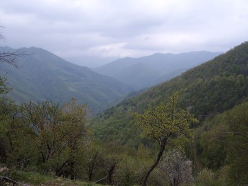
The terrain is mostly mountainous with an average altitude of 818 meters and a displacement of 345 meters. Within the municipality includes parts of Mala Mountains southern slopes of Koznitsa and big mountains and the Iskar Gorge, where is concentrated the bulk of the settlements. Features of the terrain and geological structures define the region as a landslide.
Watercourses and water areas within the municipality occupy 3630 acres, which is 0.42% of the total territory. The largest river that passes through the territory of the municipality is the Iskar River.
 Climate
The territory of the municipality is in the temperate sub the following three climatic regions :
- Climatic regions of high fields in West Central Bulgaria;
- Climatic regions of the hilly and low parts of West Central Bulgaria;
- Mountain climate region - the mid- section.
This determines the cold winters, cool summer and early autumn comes, compared with other parts of the country.
Along the river Iskretska (tributary of Iskar River) has a specific microclimate suitable for medical treatment of lung diseases.
Natural Resources
Massif region is mainly karst. On its territory there are two large karst springs - over Iskrec and Lakatnishki rocks ("Zhitolyub").
Geological structures of the region are represented by aggregates of Triassic, Carboniferous, Ordovician, Jurata. These are mainly limestone, dolomite, sandstone, argeliti, quartzite, marl, and many others, Ponorskoto plateau is most figuratively speaking, "perforated" with numerous caves and pits, some of which are rich in stalactites and stalagmites.
 The area is rich in limestone and limestone formations that in the past were a prerequisite for the development of production of lime. Lime has been off the coast of Iskar river - from Vlado Trichkov to Cherepish, but it is best organized production near Iskrec near the cave where the eponymous river rises Iskretska. There are also deposits of lead - zinc ore and granite.
Millions of years ago Stara Planina is equipped with a stock of huge wooden tables, which are then converted into anthracite. Due to the numerous folds of earth layers, anthracite is "housing" or individual wells that are located on the surface of the earth's crust and are comfortable to use.
Terrain - mountainous terrain, most of which is occupied by forest areas - 495 970 ha, which represents 57.26% of the total area of the municipality.
Agricultural land amounted to 322.705 acres, and most of them hold the natural grasslands. Only 1.41% of the total area fall on farmland or are about 12,242 acres.
Watercourses and water areas within the municipality occupy 3630 ha, which is 0.42% of the total territory. The largest river that passes through the territory of the municipality is the Iskar River. Other major rivers are relatively constant flow and flows into the Iskar River are: Iskretska, Skaklia, Proboinitsa, Leskovska, Gradeshnitsa Batuliyska, Gabrovnica and others. All the rivers in the region flowing in deep river beds that shape places and low river sediments.
 The area is the abode of many plant and animal species. Over 40 species of them are listed in the Red Book of Bulgaria , the most famous of which is The golden eagle .
The main minerals that are found in the region:
hard coal - located in the villages of Thompson, Batulia, Tseretsel;
copper and lead-zinc mining fields, located near the settlements Vlado Trichkov, Gara Bov, Lakatnik, Osenovlag, Milanovo which at today's moment in the process of privatization or liquidation;
uranium deposits along the river and Proboinitsa, Gubislav
Farming
The territory of the municipality is 311 thousand hectares of agricultural land including 18 thousand acres of fields, 125 thousand ha of meadows and 7 thousand ha of plantations. In these landscapes can be expected the development of agriculture. Despite the difficulties, however, it is this mountain and hill farming is a source of help to feed a significant part of the households in the municipality.
Significantly better opportunities for livestock. In the villages of the area people raise many cows, sheep, goats, pigs, chickens and other birds.
Big Forest Resource predisposes timber. On its territory there are 512 thousand ha forests, including 46 610 ha of municipal and 59,600 acres of individuals.
Weather conditions and mountainous terrain in the municipality allow the development of beekeeping forest fruits, herbs and mushrooms.
 In the gorge of the Iskar river passes the main railway line Sofia - Mezdra - Upper Oriahovitsa. The line is double and electricity is part of the big ring railway in the country. Within the municipality are these railway stops and stations - Vlado Trichkov, Lukovo, Rebrovo, Thompson, Orlin, Svoge, Zhelen, Tserovo, Gara Bov, Balkan, Lakatnik, Opletnya, Levishte and Prolet. Rail greatly simplifies the lives of people - local residents have cheap and convenient transfer in both directions - and the capital associated with short-term economic migration, use of health care and administrative services, etc. to northern Bulgaria as well. On the other hand, the railroad makes Svoge Municipality easily accessible destination for tourism and leisure, increase the region's attractiveness to business and favorably affects the economic development of the municipality.
Along the gorge, almost parallel with the railway line passes and 16 secondary roads connecting Sofia with Northern Bulgaria. Along the river Iskretska passes the164 third class road connecting Svoge road artery 81. Svoge Municipality has 218 kilometers fourth class roads, mainly mountain roads, over 80% of them - paved. The main problems concerning the maintenance and development of the local road network associated with lack of funds for maintenance and investment in road infrastructure and the present trend continuing deterioration of infrastructure, driven by both the crossing of the mountainous terrain and the intensity of water erosion especially on roads with gravel roads and pavement of ground bed.
Svoge Properties

