Bolyarovo, Bulgaria, information about Bolyarovo
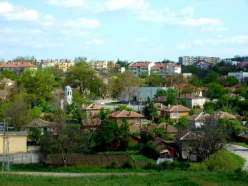
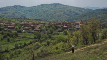
Bolyarovo Properties Bolyarovo municipality is located in the south of Yambol region, on the northern slope of the Strandzha Mountain. It covers part of Tundzha hilly area, Dervenski Heights and southern slopes of Bakadzhitsite. The majority of the land are fields - about 22349 acres. The agricultural land part of the municipality also includes the wooded area, which is about 7068 acres; roads and other land around 10051 hectares.
The overall plot of land is undulating, cross-country by a number of ravines. Larger are: Sanar dere, Mustanov Geren, Popovska cheshma, Kapakliytsi, Idzhidere, Dundzhik, Penchev dolu Sarancha, Akala, Kelikya, Suidzhik, Kaynardzha and other smaller ones.
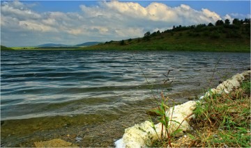
On the land of Bolyarovo pass four rivers, and the biggest is Popovska River. It is a tributary of the river Tundzha and encircles Bolyarovo from three sides of the south, west and north. The dam that was built on this river is Malko Sharkovo. Another larger river, a tributary of the river Popovska is river Koshudere. All the rivers are full of fish. There are good conditions for breeding kalabalaka, alaya, barbel, eels and others. Recently by restocking of the dam Malko Sharkovo can be seen fish such as carp, perch, and other types. The waters of the rivers are clean, except for the river Popovska.
 Around 1700 the Turkish sultan passed in possession of Murad Pasha, for good service, the lands of the village Mamarchevo (Muradanlii). Coming here, he began to think how to expand their land. He could not expand them in the west, because there is another ruler Pasha Daud, creating village Daudbegliy, which is the current village Zlatinitsa. The south is wooded and hilly, so he decided to expand their land to the north and reaches the river Popovska. The new village is named Chochonokazasa or this is Murdanal-Pashakyoy.
The rurel comes to live in the newly established village. By his order is made a large mosque dome and crescent. Near the mosque is made deep well.
They built a public bathroom near the mill later called "Peasant mill". The mill was south of the village and the wheel was powered by the water from the river. The dam is near Kazlaritsa. Bath water is taken from the river by gravity because the building was built below the pipe, in which water flows. All wheels are made of wood. The Pasha built a large wooden bridge on the river, which connects the two villages in the road. Near this place on the left bank of the river there was a very good source of drinking water, the so-called Kadansko well, which until recently existed, but it was destroyed. All this suggests that the bridge was also needed for going to the well for water throughout the year.
 Great Mosque existed until the end of the 1919 - 1920 year, after it was torn down and the material is taken for making a school. The mosque served as a school of Bulgarian children after our liberation from Ottoman rule. And there are now preserved parts of the wall of the public bathroom.
Then begin to come other Bulgarians who work for the pasha and settled and started living here. But all have started building houses on the north. So gradually were formed two neighborhoods - Bulgarian and Turkish. According to the legends and memories of people it is assumed that the first Bulgarian house in the village was built in 1780. After the formation of the Bulgarian neighborhood more settlers - Bulgarians come to live here. Perhaps this happened because the conditions were better for living. The village is located near the river, which surrounds it on three sides, which means that there is enough water for people and livestock. People believed that by living close to such great men as the Turkish ruler they will be protected from attacks.
Municipality is Boliarovo is an intersection of ancient civilizations, where ethno cultural processes run from the northwest (the Balkan Peninsula, Central and Western Europe) to the southeast (Asia Minor and the Middle East) and vice versa. This determines the specificity and richness of the cultural heritage of this region, which is reflected the result of centuries bearing imprints of violent events and unbelievable vicissitudes. Revealed were14 archaeological sites, ancient churches- 5 and 5 castles that testify to a rich and ancient past, which makes the residents of Boliarovo rightly proud.
 First monuments of unique Thracian culture:
• Medieval village and medieval castle fortress (V-VI centuries). As a fortification near the border with Byzantium had important implications for the preservation and strengthening of the Bulgarian in these lands. Partially explored.
• The old settlement of XIV-XVI century and the remains of a church on the banks of the river Popovska. Studied through unorthodox methods.
• A Thracian settlement remains of two tombs. Area of 30-40 acres. Unstudied.
• Roman settlement. Ruins on the River. Unstudied.
• Fortress of V-VI century with comb and thin ceramic ornament from XI-XII century and medieval Bulgarian pottery, remains of buildings at the time of the Emperor Justinian. Unexplored.
• Tomb of the church of V-VI in two castles - large and small ruins. Near the small gradishte disclosed church with frescoes imitating marble and plaster frescoes. Partially explored.
• Three churches, archaeological excavations which have the potential of great scientific value. Partially explored.
• Medieval castle ruins. Area of 12 acres. Unexplored.
• A chain of forts guarding the road to the capital of Byzantium. Partially explored.
• A small part of these attractions are revealed through archaeological studies of the comprehensive research program "Strandja-Sakar" (1985-1988 years). Archaeologists date the oldest remains of V century BC - Findings of the Thracians.
Bolyarovo Properties

