Information about the town of Aytos
Aytos Properties Aytos municipality is located in the eastern part of the Republic of Bulgaria. Borders the following municipalities: to the north - with Rouen, to the west - Karnobat, south and southeast - with Burgas and east - Pomorie. Covers the southern slopes of the Balkan Mountains and river valley Aitoska.
Aytos city is located 365 km from Sofia and 204 km from Plovdiv. The terrain is mostly flat. 6 km north - northwest of the town is Aitoski Balkan part of the great slopes of Stara Planina. Aitoska Pass goes through the municipality in the Eastern Balkan Mountains, connecting Burgas to Varna region.
Aytos is located on the railway highway Sofia - Plovdiv - Stara Zagora - Karnobat - Burgas. And leads to the sub-Balkan railway line and the main road Sofia - Bourgas - Varna. Geographical location determines a critical area of the municipality as a hub through which carried the road connections between North and South Bulgaria in this part of the country. Its proximity to the Black Sea, provides a sea route to the Black Sea region and the Middle East. Construction of section Aytos - Maglen in the direction of Sunny Beach resort will bring in traffic to the municipality regarding this major tourist center.
The name of Aytos in Greek means Eagle. Indeed, as eagles wings spreads at the foot of the two slopes of the low mountain Aitoska, the head of the eagle 's heading to the most - the lower part of Aitos field formed along the river Slaveeva.
 Aytos and its surroundings are so close to the Black Sea that can rightfully be called the entrance of the Black Sea. Lovers of the sea and its scorching sands, which are addressed to the Black Sea, when they get Aitos, attracted by its natural beauty, are always tempted to stay and relax in it. And here they can visit restaurants and taste the wide range of dishes - specialties and tempting fruits and wines.
Aytos entrance is a big southern Black Sea resorts of Burgas, Sunny Beach, Nessebar, Pomorie, Sozopol, Primorsko, Ahtopol. 15 km in the direction to Burgas are known since antiquity the Burgas Mineral Baths, who are nationally renowned healing powers. Aytos Municipality is characterized by high natural potential. Although small in size, it has a varied topography. Northern parts all along the east-west is occupied by the southern spurs of low grade (700 m) Aytoska Mountain. Slopes and gradually lowering, rounded contours and places pass into spilled hills.
The mountains are cut by numerous fields. The predominant slope of 11-20 degrees allows tracking and alignment of the slopes and their use for permanent crops - vineyards and orchards.
The southern part of the municipality is occupied by Aytos field, which is a peripheral part of the Burgas plain. Located on the quota of 60 to 100 m with a slight slope to the river Aytoska.
The climate in the region is mountain - sea. Fresh eastern sea wind reaches Aytos in the afternoon hours. Aytos locals have called this wind with the euphonious name "Moryanin". Winters in the city and its surroundings are soft.
 Municipality Aytos falls in the transitional-continental type of climate. The eastern parts are covered by the Black Sea climatic zone that is characterized by a specific manifestation of wind circulation.
Winters are mild - the average January temperature is positive (+1.0 ° C). In July the average monthly temperatures are 23 degrees. The average annual temperature is 12.2 ° C. The absolute maximum temperatures reach very high values - the highest measured absolute maximum temperature reached 42 degrees (in August) and the lowest maximum reached -22.1 ° C (January and December).
Spring is relatively cool and the autumn - a long and warm. Summers are hot, with sunshine duration 942.5 hours.
The average duration of sunshine is 2324.8 hours. At the early date of the first frost is October 9th and last - March 18. The average length of frost -free time was 203 days. The period of persistence of air temperature above 5 ° C occurs between 5 and 10 March and lasts 268-287 days. This favors the development of thermophilic cultures.
Precipitation that falls annual average is 538 mm (below average), unevenly distributed throughout the year. Maximum is in summer - 160 mm. During other seasons noted a roughly equalize the quantities in winter - 120 mm, spring - 130 mm and autumn - 128 mm. This is due to the influence of the Black Sea. Although the maximum rainfall in summer, for it is characteristic of drought - for the season reached 17.9 days. Most are long droughts in autumn - about 18.6 days. Drought is during the growing season reaching 14.9 days. This requires irrigation of crops in the spring and summer. The region is dominated by winds (23.5%), shortly after their frequency are Northwest - 20.6%, and the Northeast with 18.6% frequency. This indicates that the prevailing winds in the area of northern components, which are the highest speed (Northwest - 4.8 m/s). Location of the eastern parts of Aytoska mountain in east-west direction appears as a barrier to flow of cold northern air masses. For the lower parts of the municipality is characterized breeze circulation from the Black Sea. By deep river valleys of the mountain is explained wind in the valley which is particularly good for hot summer nights. The relatively high percentage of quiet time - 45.3% per year is determined by the hollow nature of Aytos field. This creates opportunities for the formation of ground-level temperature inversions and determines the mean high potential for contamination of the area.
 Due to high evaporation in summer and frequent droughts in many of the tributaries of the river Aytoska has built small dams (average 50-80 ha area) used for irrigation of agricultural land and farming activities).
Aytos municipality is rich in mineral water - hot and cold. Most of the springs and wells have healing qualities, but have built facilities in which to make the relevant procedures. Currently mineral waters can be used for healing purposes only by drinking. In the municipality were discovered mineral waters and wells, some of which were put into operation with business objectives.
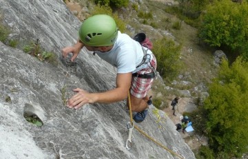
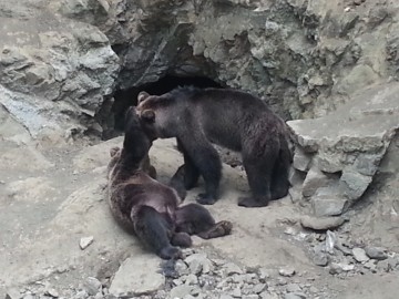
In Aytos municipality there are several protected natural sites and territories. "Aytoska kuria" is the only country artificially planted oak forest that exists over 400 years. Interesting is the gorge "Djendema " near the village Karageorgievo and "Vodopadcheto" near the village Pirne. Adjacent to Aytos is the mountain resort of Topolitsa. It is situated 12 km west of the city, on the southern slopes of the Aytos Balkan Mountain. It includes two resort areas - "Topolitsa" and "Byala reka". Park "Topolitsa" is 3 km from village of Topolitsa and covers an area of 410 acres. There are many huts built by companies from Bourgas Municipality Aytos. One of the frequently visited huts is Geranium. There are 40 beds on two floors. There are rooms with three, four, five or more beds. The chalet is equipped with central heating, with common toilets and common room with 30 seats. The "Byala reka" is located at the foot of Mount "Ostritza" - 666 m altitude, 19 km from the Municipality. It covers two adjacent slope rivers Bashbunar and Byala reka with a total area of 2200 dka. Clear spring water which is pleasant to drink, and dozens of streams form the north Byala reka, which gave the name to the whole area. The whole area is covered with deciduous forests and spacious grounds at the foot of the mountain are covered with orchards, vineyards, walnut and almond trees that add decoration to the landscape. In the land of the 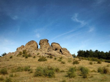 municipality is located Aytos forest park "Slaveeva River". It is a suburban park area of 1337 dka, of which 422 dka are forest. It is a great place for recreation and sport for the guests and residents of the city. The park has a wall climbers, which is used by amateurs and indoor shooting range, which is an excellent base for sports and games. There are built restaurant and parking lot with more than 50 seats for cars. Nearby, a large meadow, is a summer stage, where in the first days of June annually locals hold the Folklore Festival "Slaveevi nights" in memory of the eminent Aytos citizen Philip Koutev. There are two playgrounds with upgraded compositional elements. Park "Slaveeva River" offers opportunities for development of tourism. Prospects of the municipality aimed at efficient use of natural resources of the park through the development of existing facilities - organizing and conducting folklore programs like "Slaveevi nights' construction and development of the old base, and creating playgrounds, bicycle paths attractions such as terrariums, water attractions - slides. The territory of the park is only for southeastern Bulgaria Zoo - Aytos. It was created on the 1st of June 1969 on the occasion of Children's Day. In 2009 the Municipality Aytos solemnly marked the 40th anniversary of its existence. The zoo is located in a mountain area on an area of 10 dka, which forms the natural habitat of the species of animals in it. Occupants are more than 200 copies exotic animals and birds of 30 species, subspecies and breeds. The guide seeks to increase the diversity, both through obtaining their own offspring, and through the exchange of animals with zoos in Sofia, Plovdiv, Stara Zagora, Varna, Blagoevgrad, Haskovo and others.
  Zoo attendance is about 30 000 people a year, it is an attractive place for all ages, especially for children. There are unique rock formations near park "Slaveeva River" – “Trite bratya" and " Kralimarkovi stapki". "Trite bratya" take the form of sphinxes with an area of 1 hectare and "Kralimarkova stapki" are depressions in the rocks resembling giant steps. With a long tradition develop also sports acrobatics.
 municipality is located Aytos forest park "Slaveeva River". It is a suburban park area of 1337 dka, of which 422 dka are forest. It is a great place for recreation and sport for the guests and residents of the city. The park has a wall climbers, which is used by amateurs and indoor shooting range, which is an excellent base for sports and games. There are built restaurant and parking lot with more than 50 seats for cars. Nearby, a large meadow, is a summer stage, where in the first days of June annually locals hold the Folklore Festival "Slaveevi nights" in memory of the eminent Aytos citizen Philip Koutev. There are two playgrounds with upgraded compositional elements. Park "Slaveeva River" offers opportunities for development of tourism. Prospects of the municipality aimed at efficient use of natural resources of the park through the development of existing facilities - organizing and conducting folklore programs like "Slaveevi nights' construction and development of the old base, and creating playgrounds, bicycle paths attractions such as terrariums, water attractions - slides. The territory of the park is only for southeastern Bulgaria Zoo - Aytos. It was created on the 1st of June 1969 on the occasion of Children's Day. In 2009 the Municipality Aytos solemnly marked the 40th anniversary of its existence. The zoo is located in a mountain area on an area of 10 dka, which forms the natural habitat of the species of animals in it. Occupants are more than 200 copies exotic animals and birds of 30 species, subspecies and breeds. The guide seeks to increase the diversity, both through obtaining their own offspring, and through the exchange of animals with zoos in Sofia, Plovdiv, Stara Zagora, Varna, Blagoevgrad, Haskovo and others.
  Zoo attendance is about 30 000 people a year, it is an attractive place for all ages, especially for children. There are unique rock formations near park "Slaveeva River" – “Trite bratya" and " Kralimarkovi stapki". "Trite bratya" take the form of sphinxes with an area of 1 hectare and "Kralimarkova stapki" are depressions in the rocks resembling giant steps. With a long tradition develop also sports acrobatics.
Aytos history, one of the most ancient settlements, known by the Thracians covers several millenniums. All artifacts discovered around the city indicate that the beginning of the existence of the settlement began 5000 years BC. Found around the "Mangalyata" and "Balar cheshma" spearheads, household and decorative pottery, votive tablets with the image of Thracian horseman and other remains show us the Thracian period of the city. The city became part of the Bulgarian state under Khan Tervel. Aetos castle played an important role in the defense system of the Bulgarian lands against the incursions of the Tatars, Avars and the Crusaders. In 1378 the city was conquered by the armies of Sultan Murad. During the Russian - Turkish war (1828 - 1829) the legendary  general Dibich Zabalkanski turned the town into a strategic point. After the Peace of Adrianople in 1829, many of its inhabitants emigrated to Bessarabia. During the Renaissance the population is actively involved in the national - liberation struggles. Vasil Levski organized a revolutionary committee in the city. After the liberation Ajtos established itself as a lively shopping center - More from Burgas. Here also opens the first girls’ agricultural school in the country. After the archaeological excavations conducted by the Regional History Museum - Burgas led by Ivan Karayotov in 1973-74, in the "Staria grad" ("Balar cheshma") three kilometers north of Aytos revealed massive walls of buildings been built with cut stone blocks mortared; bases of columns, stone cornices, gutters, remnants of the heating system, bricks and tiles. This place was an ancient settlement, which was called Aquileia . It included a road station buildings from the pre-Roman and Roman times, a total area of 22.5 hectares. Architectural fragments indicate that the monuments were rich architectural decoration. The village was supplied with water and heating duct system. The Committee for Arts and Culture - Sofia and the National Institute for Monuments of Culture, declare the remains of the village is designated as a cultural monument, which falls under the protection of the Monuments of Culture and museums.
 general Dibich Zabalkanski turned the town into a strategic point. After the Peace of Adrianople in 1829, many of its inhabitants emigrated to Bessarabia. During the Renaissance the population is actively involved in the national - liberation struggles. Vasil Levski organized a revolutionary committee in the city. After the liberation Ajtos established itself as a lively shopping center - More from Burgas. Here also opens the first girls’ agricultural school in the country. After the archaeological excavations conducted by the Regional History Museum - Burgas led by Ivan Karayotov in 1973-74, in the "Staria grad" ("Balar cheshma") three kilometers north of Aytos revealed massive walls of buildings been built with cut stone blocks mortared; bases of columns, stone cornices, gutters, remnants of the heating system, bricks and tiles. This place was an ancient settlement, which was called Aquileia . It included a road station buildings from the pre-Roman and Roman times, a total area of 22.5 hectares. Architectural fragments indicate that the monuments were rich architectural decoration. The village was supplied with water and heating duct system. The Committee for Arts and Culture - Sofia and the National Institute for Monuments of Culture, declare the remains of the village is designated as a cultural monument, which falls under the protection of the Monuments of Culture and museums.
 In the center of Aytos, on the corner of 'Vasil Levski and " Krasna " streets, is where works revealed wall of V - IV century, known as the Ancient fortress in the center of Aytos. It has a rectangular shape and an area of 5.5 ha. Part of the fortress wall thickness is more than 2 meters and is preserved by building on "Vasil Levski " str. Its purpose is not well understood, but is believed to be part of an underground network of communications galleries of the ancient city that existed in this place. Of Translated from the Greek "Aetos" means eagle, ie it is called "Eagle Fortress". It was formed as a support point of strategic importance - to guard the passes and serve to shelter the population from the nearest village. Nowadays the territory of the deposit is based retransmission tower with adjoining building.
Aytos Properties

